Day 22 - Polkerris to Fowey
- Paul Juckett
- Jun 28, 2020
- 3 min read
Today started out showery, with a gusty wind, so the sensible thing to do was leave the walk until the afternoon and so, at around 1315hrs, Mags and I set off from Polkerris car park.
A steep zig-zag path leads from the beach up the wooded side of the combe for about a third of a mile, before opening out onto the top of the cliffs. The wind immediately made it's presence felt, with gusts so strong that at times you felt it would knock you over!
The views across St. Austell bay are pleasant, with Par Beach, Crinnis Beach, Charlestown and Polruan beach all easily visible, but the wind reminds you to keep your head down!

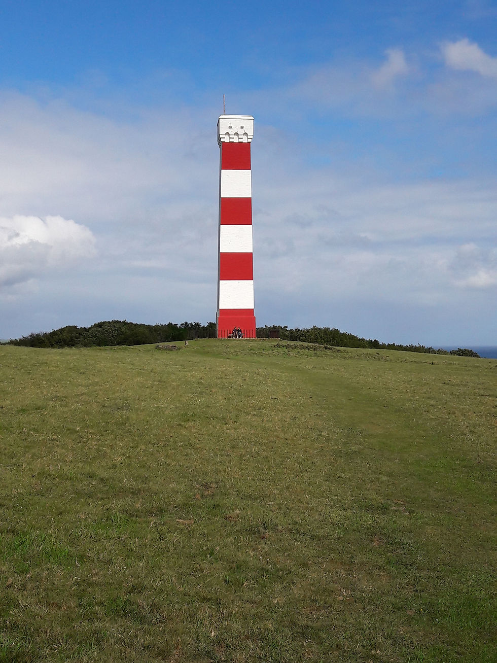
A gentle two mile walk brings you to the 25 meter high day marker on top of the 75 meter Gribbin Head.
After Gribbin Head, the path drops steeply down to Polridmouth (known locally as Pridmouth), a beautiful little cove, where swimming is safe, but there are no facilities.

The land to the right of the picture (the lawned area) is private and forms part of a holiday let (a real shame that no one actually uses this location as home!), and was originally part of the Manabilly house estate.
Daphne du Maurier lived in the nearby Menabilly House for a while and her book 'Rebecca' is set in and around Polridmouth.
The ornamental lake had lights set up around it during WWII to draw German Bombers away from the Harbour at Fowey, especially in the build up to D-day, when there wer lots of American troops embarking.
A steep path rises out of Polridmouth and takes you across farmland and the across a couple of small rocky coves, before you arrive at a small wood where the path divides. Take the path going right, to go around the small headland and above St. Catherines Castle. A path branches off down the hill to your right after a coupe of hundred meters, which takes you right into St. Catherines Castle. Built in 1530 during the reign of Henry VIII as part of the coastal defences against French / Spanish ships, it overlooks Fowey harbour and sits opposite Polruan Castle built at the same time.
It was used as an anti-aircraft gun emplacement during WWII. https://www.english-heritage.org.uk/visit/places/st-catherines-castle/history/


The view above is from St Catherines Castle, looking down the Fowey Estuary. Polruan Castle can be seen middle right of the photo, with Fowey on the left.
Leaving the castle and heading down the hill through Covington woods, you pass a flight of steps up to the remains of a structure (just the foundations), before the path switches back down to Readymoney Cove and takes you past a house once owned by Daphne du Maurier.

The walk from Readymoney cove is along roads to the Fowey Polruan foot passenger ferry. Fowey itself (up the hill to the town centre) is full of history, The Ship Inn, formerly the 16th Century townhouse of The Rashleigh family was the Roundhead headquarters during the civil war and John Rashleigh's ship Francis of Foyle sailed from Fowey when it accompanied Drake and Raleigh on their voyages and fought against the Spanish Armada.
The picture below is Polruan Castle from Fowey town.

For those wishing to continue their walk along the coast, the ferry departs opposite Polruan from here:

For Mags and I though, it was time to retrace our steps and head back to Polkerris. A round trip walk of 9.4 miles which, appears to have broken my wife.


Comments