Day 44 - Low cloud on high cliffs
- Paul Juckett
- Jul 24, 2020
- 2 min read
Today's walk was From Chapel Porth Beach to Portreath and, in a rare early morning appearance, I was joined by Mags.
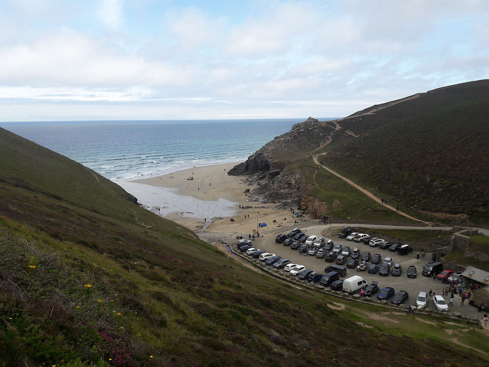
when we arrived at Chapel Porth Beach car park, the clouds were very low, with the top of the cliffs that crowd the small parking area barely visible (the picture above was taken when we arrived back at around 13:30hrs, looking East).
After a fruitless battle with the parking machine and having to write a note for the parking attendant, we set off up the long zig zagging path to get to the top of the cliff.
Once at the top, visibility was down to about 100 - 150 yds, but at least it wasn't raining.
Around one mile later, the path begins to drop down to Porthtowan, another small resort that is home to a sandy beach and a few cafes / restaurants and a pub (once again, photo taken on the way back, looking East).

After a fruitless walk across the beach and across a small stream (caused entirely by my refusal to consult my Bartholomews guide to the Cornish Coast path) we finally headed inland on the small road to find the even smaller un-metaled road that climbed up to the cliff top where the footpath resumed!
However, due to my unplanned detour, we did come across this building that derw our attention.

Research when we got home, revealed that this had been converted to be a Cafe, having previously been built in 1872 as the Engine House for Wheal Lushington copper mine, but was never actually used as the industry had passed it's peak by then and Cornish miners were emigrating to countries like South Africa, North America and Australia where their skills were in demand (In the first six months of 1875, over 10,000 miners left Cornwall to find work overseas).
Carrying on along the cliff tops towards Portreath takes you past another (partially) preserved mine, although we couldn't see it until we nearly tripped over it, the chimney is a grade II listed building (presumably because it's square rather than round).

This mine was redeveloped in the 1920's by the London Tin Syndicate Ltd, but produced little and soon closed.
The path runs along the fence of RAF Portreath (now disused) and the RRH Portreath air defence radar station (still operating) for about two miles. Previously used as a chemical weapons research centre it now has few active personnel.
Eventually, as we had just about reached Portreath, the clouds lifted and we were able to see the coast around us!
Portreath has a beach and a harbour that are divided by a wall. In 2014, the wall and town were badly damaged during storms and again, to a lesser degree, in 2018.


We set off back to the car, and only on the way back did we notice how steep the cliffs were, it was lucky that we hadn't taken a wrong course through the clouds!


Comments